 So I spent the night at the Gila Hot Springs campground. It was nice for eight dollars there wasn’t any showers or trash cans but that was OK; ended up sharing my site with Lotta the dachshund and her friend Kevin who are riding a bicycle from Austin Texas to Los Angeles.

 The next morning I got up, packed up and headed back up to the store to use the Wi-Fi and to make sure everything was charged. I was headed to The Gila Cliff dwellings national monument.
 The actual Clift Dwellings would be a 5 mile round-trip off trail, but the visitor center was actually on the trail so I hiked to the visitors center and got permission to leave my pack there on the bench outside; and I headed toward the cliff dwellings. Since it wasn’t actually part of the trail I was able to hitch hike and a nice old couple picked me up and took me to their campsite about a half mile before the dwellings. I quickly walked the rest of the way, and when I arrived at the entrance to the 1 mile loop that would take me up to the cliffs a ranger was there and I showed her my National Park pass. She then gave me a lecture about how the path was a mile long, unpaved, and gained over 300 feet in elevation. She went on to tell me that if I did not feel that I could make it I should turn back. After assuring her that I felt confident in my abilities to hike a mile even if it wasn’t paved, she begrudgingly let me pass. The ruins were incredible. They were high up on the canyon walls built into large caves in the cliffs. There wasn’t a lot of information about the Mogollon people that had built them but that’s probably because we just don’t know much about them.


 I toured the caves and walked the rest of the loop back to the parking lot. When I got there I saw Kevin and Lotta again and said hello and goodbye. I started walking back to the center to get my pack and saw some cool pictographs on the rocks.

 A couple in a Volkswagen Vanagon gave me a ride the rest of the way back and I got my pack and headed up the trail. Soon it turned left and went back down to the river, and almost immediately crossed it. The trail was quickly lost to the brush and rock and it was back to bushwacking. As I made my way deeper into the canyon the walls rose high above on either side. I had made a late start, and then went to the ruins, so I was not that far along when the sun vanished behind the walls. I found a campsite that was flat and relatively free of rocks and stopped about 5 pm. I set up, made dinner and crashed for the night having made it 8.8 miles on trail for the day and crossing the river 20 times.
On Wednesday the 10th I awoke to a beautiful day. The sun doesn’t make it deep into the canyon until around 9 but I was already hiking a little after 8. It was a day of gorgeous scenery and a day of battling the river. Sometimes I would have to cross three times in a hundred feet. The current was strong but luckily it didn’t seem as deep as it had below Doc Campbell’s. Still it was constantly trying to wash me off my feet. At times the river bed was a slab of slippery rock that I had to slowly slide across inch by inch anchoring myself with my tracking poles, At others it was strewn with large rocks; invisible in the depths that had to be felt out by foot.
For the most part the trail was non existent and the only rule was keep heading upriver. I was constantly climbing over dead falls and driftwood, forcing my way through dense bushes and underbrush. It was a tediously slow way to travel. Twice I crossed on logs that spanned the river. 
 The first was a fallen giant. The log was easily 15 foot around and I was able to walk across. The second log was much skinnier. A pine that still possessed some of its bark. As I slowly worked my way across the bark started to loosen and slip away under my feet nearly plummeting me into the river. I leapt the last few feet and landed on the bank shaken but safe.
Shortly after 4 that afternoon; as the sun disappeared behind the canyon walls I hit an empasse. The canyon narrowed to a rock wall on both sides and the river became a raging torrent. I was tired, soaked to the bone and getting cold without the sun’s warming rays so I decided to make camp. I had made it a mere 11.7 miles but had crossed the river 105 times. 
I climbed up the canyon to look for a flatter place to camp and found a small depression where I could pitch the tent. The depression actually created a way through and around the rapids with a steep descent back to the river. I decided I would try it in the morning.


I dried out my clothes as best I could and went to sleep.
I woke up in the morning of April 11th and it was cold. My water has frozen during the night and so had my shoes. Generally when on a thru hike if your shoes are wet and you know that it is going to be below freezing you unlace your shoes before going to bed so that you can get them on in the morning when they are frozen stiff. I didn’t realize it would be getting that cold so I hadn’t unlaced mine. It took me twenty mins of beating them against a tree and working them loose to manage to get them on my feet. I remember a frozen morning on the AT when while hiking in the snow I came upon a hiker with his trail runners on the back of his pack and crocs on his feet. Upon noticing me he gave a look, full of despair,and said “they are frozen I can’t get them on my feet” I nodded my understanding and hiked by unable to reduce his misery.
When I finally got my shoes on I knew I had to start hiking before I froze, of course hiking meant wading the icy river but I had no other choice. I made my way down the descent and waded in, god it was cold, so freaking cold. I made it through and kept hiking just focusing on moving fast enough so that I didn’t freeze. As I fought the river,a cold wind started howling down the canyon from the north trying to both blow me over and freeze me in my shoes. It was a cloudy day and the sun wasn’t to be seen. 

At some point while standing in the river, I noticed it had started to snow.
This was worrisome I knew hypothermia was quickly becoming a very real risk. I also knew that there was a high route approximately 5 miles ahead that exited the canyon and climbed up to a campground away from the river and then came back down the canyon about 8 miles further on. This meant I could leave the river before sundown maybe dry off a little and not have to cross it first thing in the morning. It seemed like the best option so I decided to try it but I still had 5 miles of river crossings to hike. It snowed all that afternoon the wind howled and I braved the current. I fought through the brush and prayed for sunny patches in between the clouds. 75 times I crossed the river before finally reaching the path out of the canyon. I filled up my water bottles and climbed. It was a steep ascent of a mile and then a gentler one of 3 miles to the campsite. The wind was still cold but at least it dried me out a little and I wasn’t wading the river. I made it to the campsite and quickly set up my tent and crawled in to get away from the wind. I had made it 15 miles.
On Friday the 12th I awoke to a calm day. It was still cold but the wind had settled down. I started hiking a little after 8 and headed back down towards the river 4 miles away. I was ecstatic that I wouldn’t have to wade into icy water first thing in the morning. This would also be the last time I would have to cross the Gila River which definitely raised my spirits. The final crossing would be just north of Snow Lake and to my surprise the wild raging river that I had been struggling with for days was not much more than a muddy ditch on this side of the lake.  It was sad in a way and I hopped across on rocks without even getting my shoes wet.
From there it was roughly 30 miles on the Gila river alternate back to the main CDT trail. I set off and immediately it was back to bushwhacking. I was stuck finding my way across the rough countryside. It was slow going but I knew that a few miles ahead I would hit a gravel forest road and follow it for twenty miles so soon I would be able to make miles.


I passed a small pond and got some water, and it started snowing again. The world had opened up and I was crossing flat grasslands. The wind was cold but since I wasn’t walking through waist deep water every few minutes I wasn’t complaining. I hiked 21 miles that day and was glad that without the river slowing me down I was able to make miles again. 

I had made it to the road and camped by a random tree. It had been quite a ways since the last water stop at the pond, but I knew there was a trough 9 miles up, a mile before I would be back on the official trail.
On the 13th I awoke to a frozen world. My tent was covered in ice and I had to bust my way out. But, the sky was clearing and a gorgeous sun was coming out. I got all the ice off I could and packed up my gear, When it’s that cold the only way to survive outside of your sleeping bag is to hike and warm yourself up, it was hike or die so off I went. I believe it got above freezing for a while that morning as I steadily climbed up towards the trail. My camp had been around 8000 feet and I would meet the CDT at 9129. At the 9 mile mark of the day, as I was walking through a pine forest I made it to the water trough. It was back to drinking out of tires.
I was becoming a connoisseur of cow troughs and the water from that one was at least an 8 on the 1-10 scale. I filled up my bottles knowing it was again a long way (over 20 miles) to the next source. I ate my lunch there which consisted of my last snickers bar and some trail mix, then hiked on. I finally made it back to the official trail about a mile later and it felt good to be home.

There were some amazing views as I hiked that day. I had to climb over two more 9000 plus foot mountains so it was a day of ups and downs, and snow. The clouds rolled in and the snow came down. The area had recently suffered from a fire so most of the trees were either gone or fallen. Still fires are a part of nature and it was a wild and beautiful place. After the burned section i reentered the forest. It was lush pines and other than crossing the occasional fence there was no sign of human presence nice. The trail was plain and though often steep it was great walking. I saw some huge elk running like wraiths through tree shadows. I knew I wouldn’t make it to the next water source that day and after hiking 25.7 miles I decided to camp; deep in the wood at over 8000 ft up. I had the whole world to myself.


The snow hadn’t stuck and the morning, though it was cold was also sunny. It was Sunday the 14th and I still had a little over ten miles to go to get water; then I would have to make a decision. The people in charge of the CDT are trying to get it completely off roads ( even deserted dirt forest ones) and taking it farther and farther into the mountains which sounds great on paper but they are not taking into account that hikers need water. Ahead after the next water source the new CDT would split right and the old CDT split left and followed forest roads and a larger gravel one for the last 6.5 miles to Pie Town. I had planned on taking the official route but according to guthooks every water source was dry and it would be over 60 miles without water. The old route was 53 miles and had one dependable water source shortly before the middle of it; 25 miles after the one I was currently hiking to. I had little choice but to take the old route or risk dying in the mountains.
The CDT is a demanding trail. Many hikers start off the AT and the PCT doing short 6 to 10 mile days and then work their way up to longer ones. The water sources are close together and you are able to resupply every 60 to 70 miles for the most part. This is not so on the CDT. Water is scarce and if you can’t cover the miles you won’t make it. Resupplies may be 140 to 200 miles apart and you can only carry so much food on your back. 6 days worth of food is a lot of weight and even at 20 miles a day that still often leaves you short of your next resupply. From Doc Campbell’s to Pie Town was 140 miles and I was on day 5 and still 56 miles away at noon. The river had slowed me down.
I hiked towards the water source known as Aragon well. When I reached the road where I was to turn right, I noticed that there was a new section of trail that continued straight instead of turning towards the water. Yup, the first water in 21 miles and the last for another 25 (or more if you take the new official route) and The CDT folks had routed the trail over a mile away from it.
I of course turned right anyway and went for the water. It was a huge cow trough. The cows weren’t two happy with me interrupting their lunch but I helped myself anyway. The main tank was vast and had loads of goldfish swimming in it. There was no way to reach the water in there but low down on the sides there were metal troughs that the water filled for the cows to drank. I walked around to the side away from the large bull, filled my bottles and made lunch.


After I ate I resumed my hike. I split off the new trail at mile 376.6 and took the old trail known as the Pie Town road route alternate. It was deserted dirt roads (really more of paths). It was actually nice to have a clear easy path to follow and I happily ambled along. Of course this was still the mountains and there were loads of ups and downs but I wasn’t bushwhacking or swimming the river so I was happy. Plus it was relatively warm and not snowing.
I made 22.4 miles that day to a small campground at mile 9.9 of the road walk alternate. The camp was at 8110 feet and my first task of the next morning would be to climb the 3.8 miles to the top of Mangus mountain another 1500 feet up at 9649 feet. But I decided to rest first and made camp. There used to be a water source there but it was now dry. I met a bicyclist named Lucy ,from France, that was riding the Continental Divide Mountain Bike Trail to Canada. There was also a hunter there in a camper and he gave me a bottle of water. As I was cooking that night my stove ran out of fuel. I was 30 miles from Pie Town.
I got up at 630 on Mon and it was cold, my water bottle was frozen but all else was well. I began the steep ascent and made good time. I made it up the mountain as the sun was rising. 
In places the trail was covered in frozen snow and I had to carefully watch my step. I was hoping to hike my first dirty 30 and make it all the way to town.
It had been six days since my last resupply and it was at Doc Campbell’s, a small store that didn’t serve food. It had been ten days since Silver City and my last good meal of town food. I had crossed the river 252 times climbed over loads of mountains, dealt with 50 mph winds, survived a forest fire, hiked through the snow, been half froze, and I was ready for a break and some real food. So I hiked, it was 15 miles from where I camped to the next water source. (25 miles from the last one at Aragorn well) It was still dirt roads that were steadily getting better and I made it the 15 miles by noon. I got some water from an actual working well pump with an on and off switch. I turned it on and fresh clean water came out. I didn’t even filter it. I was nearly out of food and ate my remaining Pay Day candy bars for lunch. I was 15 miles from town.
After I got back to hiking a guy on a dirt bike rode up and said hi and said something I couldn’t quite hear above the noise of his engine about looking for a sign ahead. I smiled and yelled thank you to be polite and he roared off in a cloud of dust. I shrugged and continued on. A couple of miles later I saw a handwritten sign on a post. I was of course thinking that this is how horror movies start but I’m a thru-hiker and we’ll pretty much try anything if there’s a chance for food so of course I turned right into the cow pasture. And in the middle of that pasture was a couple of semi open green metal sheds with a washer, a dryer, a fridge full of eggs and bacon a propane stove, a toilet, and a shower with hot water. I knew the place in town I was planning to stay might or might not have water and laundry ( more on that later) so I just went with it. I made myself at home. I put my clothes in the laundry (detergent was provided) found a brand new towel and some cotton shorts in a bin took a hot shower and started making eggs and bacon sandwiches. Cows would wonder by every few mins as I made myself at home.


Eventually as I was enjoying my sandwich the guy on the dirt-bike road up and said the place was his daughters idea and it had just opened. He put up a new Davila Ranch sign and said that they were having WiFi installed the next day all they asked for was donations. I told him that he needed to put it on the guthooks app that all of us hikers were using for navigation and he asked me if I would tell his daughter about it . I said sure and he called her and handed me the phone. I explained to her what it was and that she should go to the website and contact the guy and tell him about her place.
While all this was going on my laundry finished so after I got off the phone I got dressed said my goodbyes and started walking the remaining 13 miles to town. The road into town is gravel ( as apparently 75 percent of New Mexico’s roads are) and mostly uphill but it wasn’t a bad walk. I finished my 30 mile walk a little after 7 at the Toaster House in Pie Town. The Toaster House is owned by Nita Larronde, she raised 5 kids here and then moved out but leaves the place open with the power on and water except when it’s cold and might freeze. ( It’s on right now) It’s a gift from her to all the weary travelers that happen to come through Pie Town; open and welcome to any and all. Last night there were three by-cyclists here, including Lucy but they all left this morning and now I have the place to myself until somebody else shows up. I have to stay another night because I need fuel and the only store in town is closed on Tuesday. I had my own room last night and an old lumpy bed. I slept better than I have in many a year here in this strange abandoned house set aside for all us adventurous lost souls wandering around the world. 
(Nita signing “I love Pie”)

New Friend


If anybody’s reading this I promise I am trying to get better at writing and editing. This is typed on my phone anywhere I can borrow some WiFi, usually on porches or picnic tables. The journey continues-Wallace
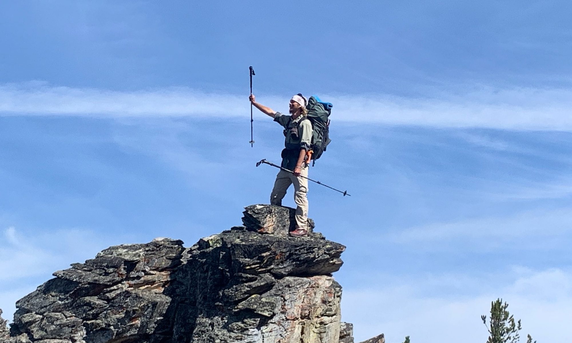
Just some pics (below)


I am enjoying the blog and can understand what the cold mornings are like. Looks like you are having some good distance days. Keep it up, we’re pulling for you..
Thank You
I enjoyed reading your blog. I am Bamadog’s wife. It is nice to meet you 🙂
Thank you and nice to meet you to 🙂
You are doing great! Awesome pictures! Can’t imagine crossing that river as deep as it is in some places so many times. I can’t imagine how cold you had to have been. Hike on brother.
Wallace, you are doing wonderful work of writing, so interesting to
read! And your photos are spectacular! Much more info than the lovely postcards we enjoyed from your AT! Hope you warm up and we’re rooting for you from much further north!
Thank You
You are making great progress. Keep it up and the river is behind you now. Great blog be safe and take care. Amy and the girls say HI.
Wow, I am so enjoying your blog, I hang on every word! Some parts sound really scary and hard to keep on keeping on but you endure and just keep moving on to attain your goals. The coldest is yet to come you know. I would love to be so far into the wilderness to feel like you are alone in the world not that I could do the walk to get out there. Must be the most awesome feeling! I am glad the river is behind you! Rest a while, eat and enjoy some rest. Be safe when you continue on, so proud of you for living your dreams:-):-):-):-):-) mom p.s. thanks for the wonderful pictures!!!!
This is whitewaters uncle. Great pictures. I live just outside albuquerque. Curious when you will be crossing I40 near grants
Sorry haven’t had signal,. I crossed it yesterday.
Awesome read Andy – you have a talent for it. Let me know if I can help in any way, and keep writing 🙂
Thank You 🙂